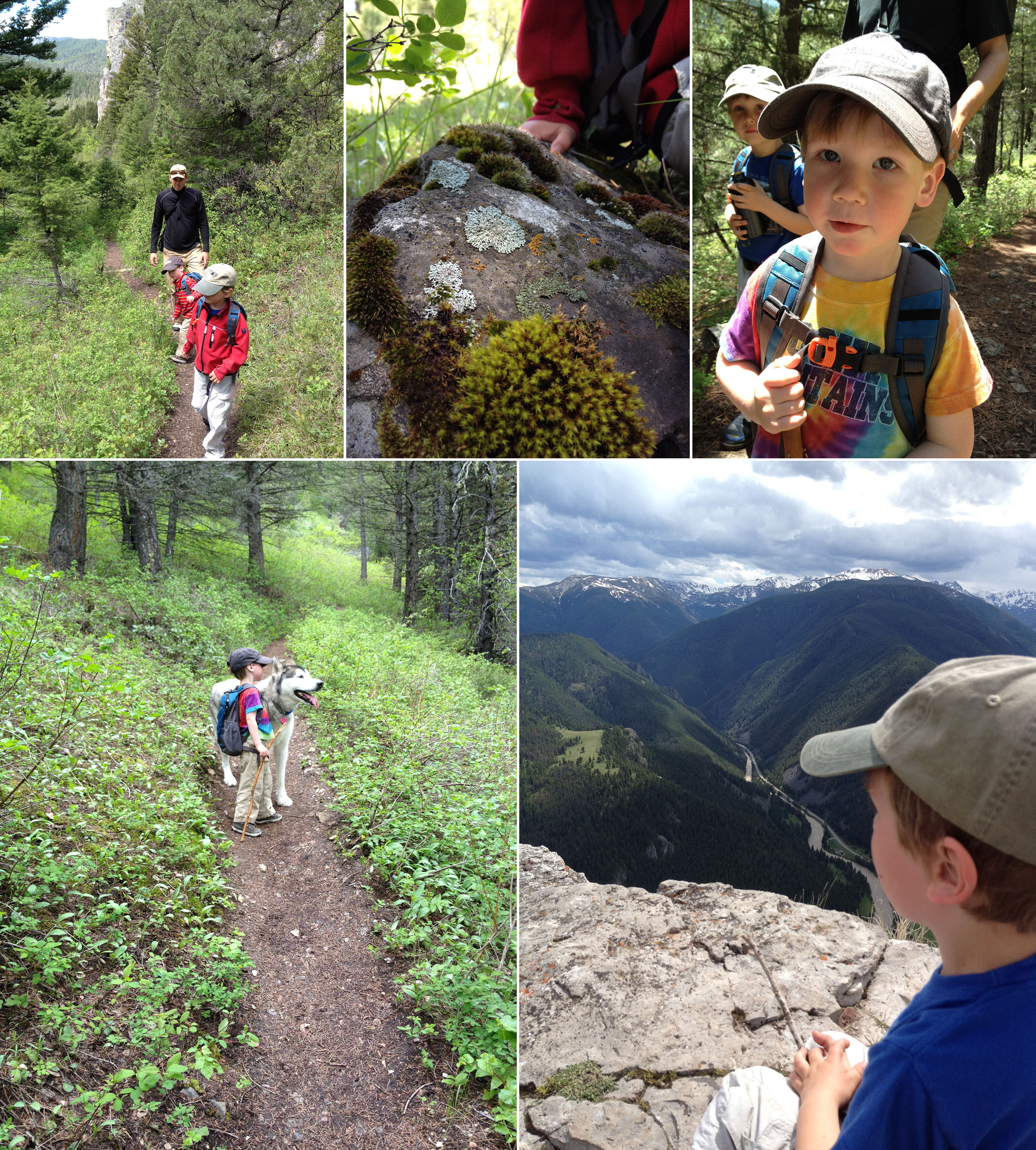
Bozeman is recreational Mecca. From mountain trails and in-town paths, to riverside strolls and forested jaunts, to wilderness hikes and wildflower walks, there is something for everyone. Visitors are stunned by the mountainous beauty surrounding the Gallatin Valley.
The Bridger Mountains to the north and the Gallatin Range to the south are as familiar as our own backyards. Locals run steep trails on the edge of town, and walk dogs along creeks. I’ve been to birthday parties along local trails, wildflower watching on the south side of the Bridgers in early spring, and backpacking to subalpine lakes from trailheads an hour from downtown.
Bozeman’s mountains are part of our identity as well as our recreational outlets. Below are some of my favorite Bozeman hikes, and I would love to hear about your favorite Bozeman hike. Comments welcome at the end of the post.
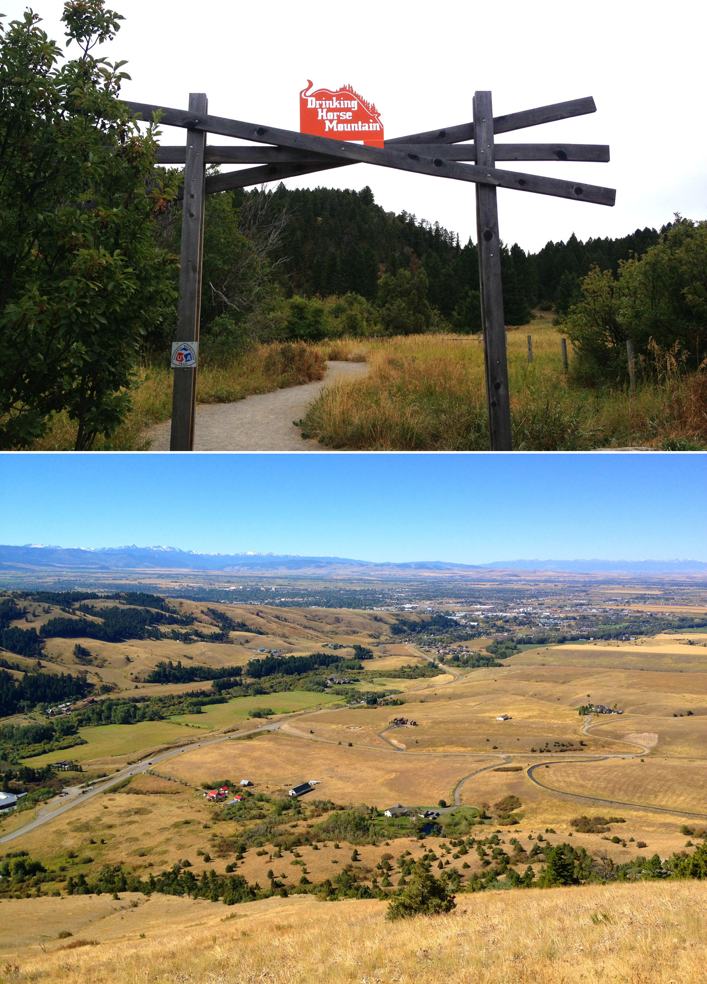
Drinking Horse Mountain
This is one of Bozeman’s newer hiking venues. Two trails, one steeper, the other easier lead to the 5,522-foot summit, where you’ll get views of the Absaroka and Gallatin ranges. The two trails make a 3.5-mile loop. It’s mostly shaded which is great on hot, summer days.
Photography by Melynda Harrison
Getting there: From Main Street drive north on Rouse, which becomes Bridger Canyon Drive (Highway 86). At 3 miles turn right (south) into the Fish Technology Center, just before the “M” Trail turnoff.
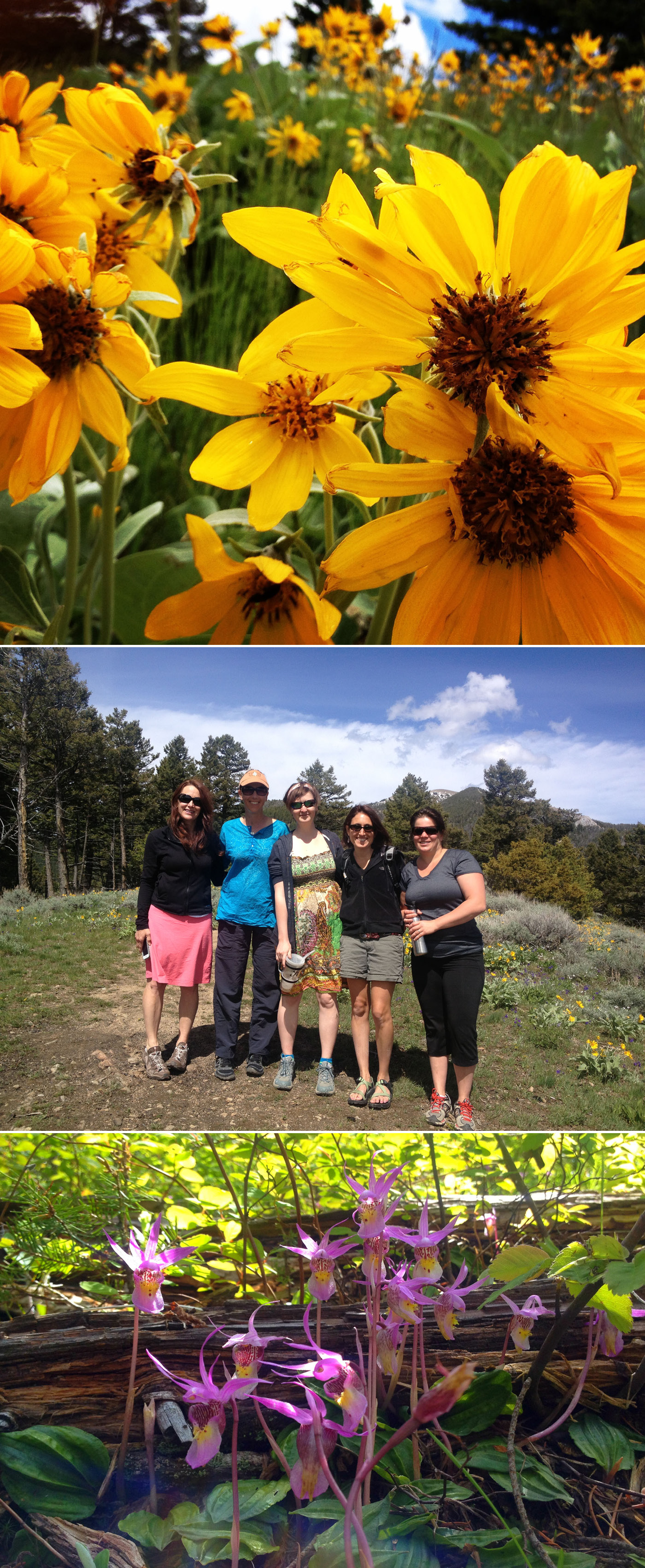
Sypes Canyon Trail
The Sypes Canyon Trail is on the steeper side, but it’s short—4 miles round trip—and ends at a beautiful overlook where you can see Bozeman, and the Gallatin, Madison, and Tobacco Root ranges. The trail follows Sypes Creek for most of the hike, then turns into the tree line. At the saddle, head right up a small hill to the overlook. Sypes Canyon is a good spot to see early season wildflowers.
Getting there: Take Springhill Road 1.5 miles to Sypes Canyon Road. Turn right and drive 3.2 miles to Churn Road. Turn right and go about 50 yards to the signed trailhead.
Middle Cottonwood Creek
Like most trails on the west side of the Bridger Range, Middle Cottonwood loses snow early and sprouts wildflowers soon after the melt. The trail follows the pretty creek past pools, cascades, and little waterfalls. It crosses the creek several times, passes lichen-covered boulders, and eventually connects with other trails. It reaches Saddle Peak after 4.5 miles, but the trail is worth a stroll, even if you don’t get that far.
Getting there: Drive north on 7th Avenue to Springhill Road. Turn right and continue 3.4 miles to Toohey Road. Turn right again and look for the Middle Cottonwood Creek sign. Turn right and drive 1.7 miles to Walker Road, turn right and drive another 3.2 miles to the trailhead.
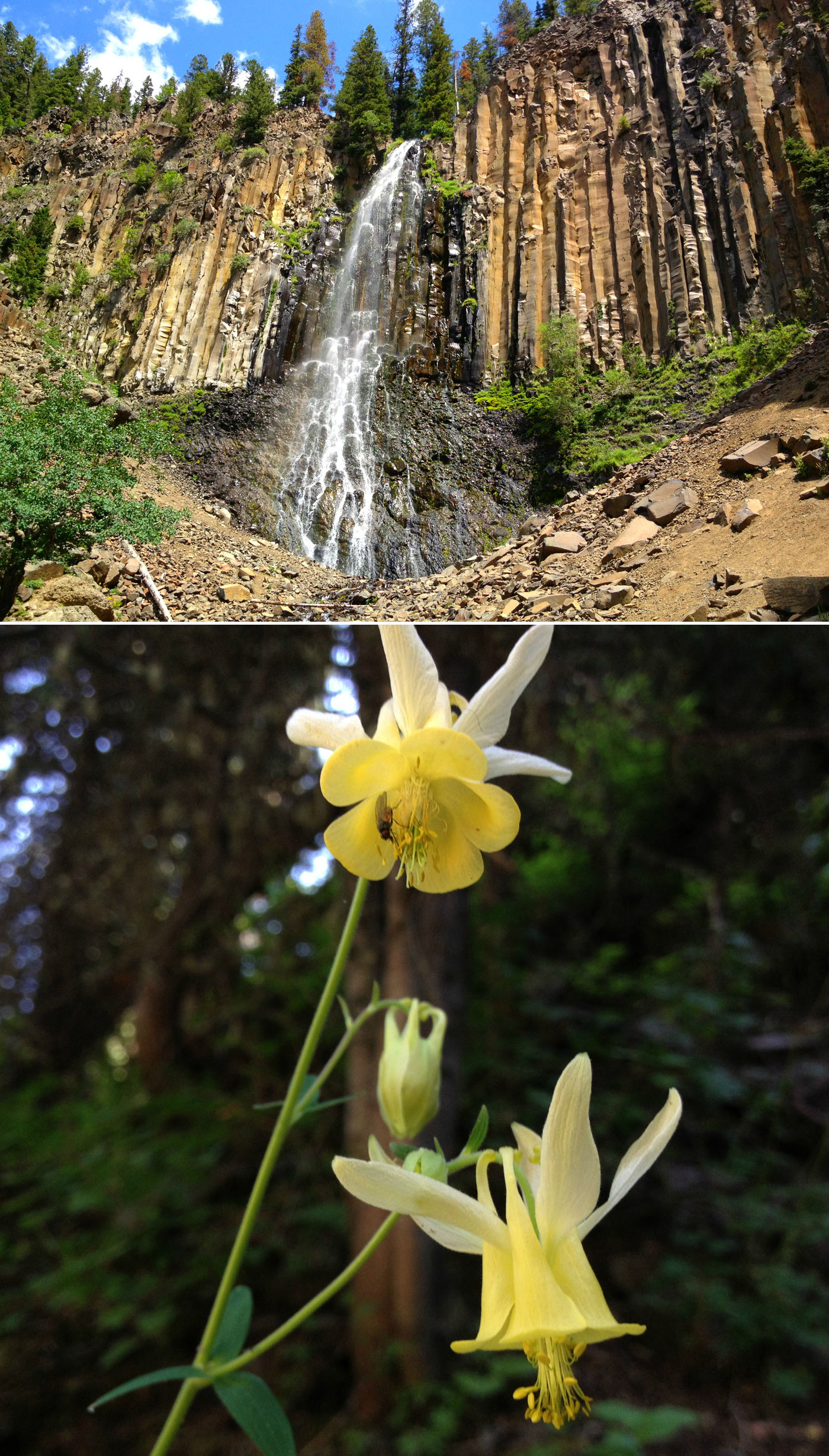
Palisade Falls
Palisade Falls National Recreation trail is a short half-mile (one way) asphalt-coated surface that leads to a beautiful 80-foot waterfall. Walk through towering Engelmann spruce and red fir as you switchback up to the base of the volcanic cliffs. Palisades Falls is the result of prehistoric lava flow, complete with massive hexagonal basalt columns.
Getting there: From Main Street take South 19th 7 miles to Hyalite Canyon Road turn left. Go south 20 miles (First 10 miles are paved.) to Forest Road. Go left (west) one mile to Palisades Falls Picnic Area and trailhead.
Emerald Lake (East Fork Hyalite Creek Trail)
The first three miles of this trail is a gradual climb, crossing the creek and passing Horsetail Falls. Then it zigzags up the hill, gaining 400-feet in elevation and passing a 60-foot waterfall. At about 4.5 miles you reach Emerald Lake. Heather Lake is just 0.5 miles beyond. Emerald Lake sits in a dramatic cirque made of Mount Chisholm and Overlook Mountain. In early and mid-summer the wildflower display is breathtaking.

Getting there: From Main Street travel on South 19th Avenue 7 miles to Hyalite Canyon Road* and turn left. Go south 20 miles to Forest Road. Go left (west) one mile and pass the Palisades Falls Picnic Area and trailhead, to the trailhead parking at the road’s end.
* Hyalite Canyon Road is closed until May 15.
Storm Castle
This is a great early season hike. Snow melts off this south-facing slope and flowers bloom long before other trails are clear. Limestone cliffs jut out of the mountainside and small muddy sections sometimes dot the trail. It’s a 2,300-foot climb in only 2.5 miles, but the view of Gallatin Canyon from the top makes the trek worthwhile. Watch out for ticks, this trail is known for them.
Getting there: From Four Corners drive south on Highway 191 for 16.6 miles to the Storm Castle Bridge (formerly Squaw Creek Bridge). Turn left and cross the bridge over Gallatin River and turn right. Continue 1.8 miles to the trailhead parking on the left.
I am always looking for new hikes or ‘old’ hikes I should revisit. Use the comment area below to share your favorite hike.